Sorry, you need to enable JavaScript to visit this website.
Skip to content Skip to navigation
 
 
The Stanford School of Earth, Energy & Environmental Sciences is now part of the Stanford Doerr School of Sustainability.
This page is currently being maintained for archival purposes only. For the latest information, please visit us here.


earth matters
science and insights for people who care about Earth, its resources and its environment

Fresh Water Resources

September 15, 2017
Stanford Woods Institute for the Environment

A new web portal puts four years of California drought data into an interactive format, showing where regions met or missed water conservation goals. The idea is to motivate awareness and conservation.

satellite image of Wadi Rum desert in Jordan
August 30, 2017
Woods Institute for the Environment


A new analysis of regional drought and land-use changes in Syria suggests water conditions in downstream Jordan could get significantly worse.
 

Purified Water
September 2, 2015

Stanford Earth scientist Scott Fendorf helped discover how trace amounts of arsenic were moving from sediments into groundwater aquifers in Southern California.

InSAR image seen through a water drop
June 9, 2015

New imaging tools developed by Stanford Earth scientists could soon inform more proactive strategies for groundwater management.

May 6, 2015

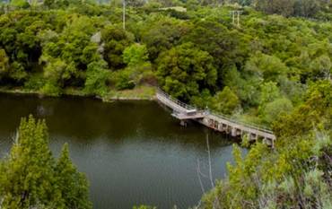
A Stanford committee that included Chris Field and Pam Matson recommends that the university develop and evaluate two alternative ways to achieve fish passage at Searsville Dam.

shasta lake
March 2, 2015

In California, dry years coupled with warm conditions are more likely to lead to severe drought than dry, cool years, and the probability of warm and dry conditions coinciding is likely to increase under anthropogenic climate change. 

Beach in Monterey Bay
December 6, 2014

Earlier this fall, a team led by Rosemary Knight performed an ambitious experiment to determine the extent of ocean saltwater intrusion into freshwater aquifers in the Monterey Bay region.

Satellite using radar technology
November 10, 2014

Geophysicists Jessica Reeves, Rosemary Knight, and Howard Zebker use satellite radar technology to view water buried hundreds of feet underground from hundreds of miles above, with guest appearances by Arthur C. Clarke and Cruella de Vil.

Rosemary Knight speaking with KSBW reporter
October 13, 2014

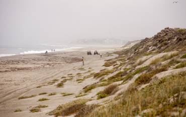
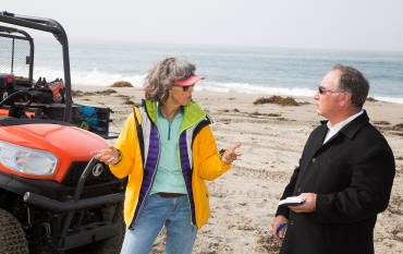
This past Wednesday was a busy day for Rosemary Knight, whose team is wrapping up a two-week long project to use geophysical tools to map saltwater intrusion into aquifers along the Monterey Coast.

Crop irrigation
June 18, 2014

Stanford Earth scientists prove that satellite-collected data can accurately measure aquifer levels, a finding with potentially huge implications for management of precious global water sources.

Irrigation circles

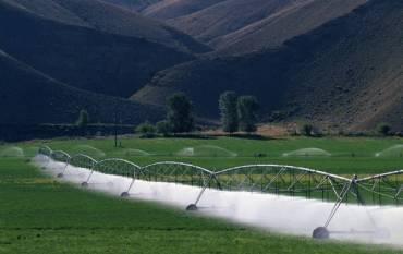
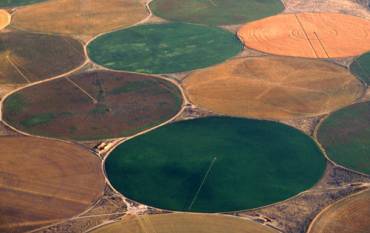
Much of the agriculture in the American West depends on underground water systems that need to be carefully moni