The Stanford School of Earth, Energy & Environmental Sciences is now part of the Stanford Doerr School of Sustainability.
This page is currently being maintained for archival purposes only. For the latest information, please visit us here.

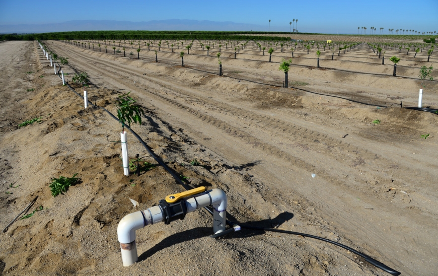
Over-pumping groundwater has drastically and permanently reduced the water storage capabilities of land in one of California’s most important farming areas.
Decades of over-pumping groundwater have irreversibly altered clay layers in parts of California’s Central Valley, causing the ground to sink and permanently reducing its capacity to store water, a new satellite remote sensing study shows.
The research, published by Stanford scientists online in the journal Water Resources Research, reveals that land in the state’s San Joaquin Valley (roughly the southern half of the Central Valley) sank nearly three feet (85 cm) during a recent drought due to over-pumping. This translates into a permanent loss of natural water storage capacity of between 336,000 and 606,000 acre feet; an acre-foot is equal to 326,000 gallons. For comparison, the Hetch Hetchy Reservoir that supplies water to San Francisco (and Stanford) has a capacity of about 360,000 acre-feet.
The San Joaquin Valley is one of the United States’ largest agricultural hubs, growing an estimated $17 billion worth of crops per year. The new findings come just as the state is experiencing its wettest season in years following an extended, record-setting drought. “California is getting all of this rain, but in the Central Valley, there has been a loss of space to store it,” said study co-author Rosemary Knight, who is the George L. Harrington Professor at Stanford’s School of Earth, Energy & Environmental Sciences.
Knight and her colleagues used data acquired with a satellite technology called Interferometric Synthetic Aperture Radar, or InSAR, to measure centimeter-scale changes in elevation in the San Joaquin Valley between 2007 and 2010. “Our work is a good example of the use of Earth-observing satellites to answer down-to-earth questions about the sustainability of water resources,” said study co-author Thomas Farr, a research scientist at NASA’s Jet Propulsion Laboratory in Pasadena, California.
With the InSAR data, the team was able to calculate the amount of subsidence — or sinking — the land was experiencing. Subsidence happens when the water pressure in the subsurface dips below a critical level due to too much groundwater removal, leading to sediment compaction. “As you pump groundwater out of an aquifer, the water pressure in the tiny pores of the sediment drops,” said study first author Ryan Smith, a doctoral candidate in Knight’s lab. “That reduces the ability of the aquifer to hold up the ground above it and causes it to collapse. That collapse is manifested at the surface as subsidence.”
If too much water is extracted, particularly from clay layers, the compaction becomes irreversible and the soil’s ability to retain water is permanently diminished. “When too much water is taken out of clay, its structure is rearranged at the microscopic level and it settles into a new configuration that has less storage space,” said Knight, who is also affiliated with the Stanford Woods Institute for the Environment.
This not only makes it more difficult to store water in the future, it also makes it harder to draw any existing water out in the present. “It’s like trying to suck water from a really thin straw,” Knight said. “The pressure that needs to be exerted to pull the water out gets greater and greater as the clay structure collapses.”
The scientists only examined InSAR data collected during the drought period between 2007 and 2010. Since then, California has experienced a more severe drought, from 2012 to 2016.
“I think it’s safe to say that the latest drought may have caused at least as much, or even more, subsidence and permanent compaction in the region than the last one,” Smith said. He pointed to recent InSAR data not included in this study showing additional subsidence from the recent drought.
One way farmers in the region could alleviate the problem, Knight said, is to avoid drawing water from clay layers and instead pumping from sand and gravel layers, which are more easily recharged and are less susceptible to permanent compaction.
Until recently, however, distinguishing clay layers from sand and gravel from the surface required drilling expensive wells. But Knight’s group is testing a novel geophysical electromagnetic method that involves flying a helicopter equipped with instruments capable of imaging the subsurface from the air to create a three-dimensional map of clay, sand and gravel deposits.
“With the right geophysical tool,” Knight said, “we can not only better understand the composition of the subsurface, but also help guide pumping and groundwater recharge efforts.”
Other co-authors on the study are Howard Zebker, Jessica Reeves, and Jingyi Chen from Stanford University and Zhen Liu at JPL. Funding for the study was provided by the S.D. Bechtel Jr. Foundation, the NASA Terrestrial Hydrology Program and the National Science Foundation.

© Stanford University, Stanford, California 94305. Copyright Complaints